

City of Kenefick · Liberty County, Texas
Our History
Settled before 1830✦Established in 1968
From a railroad stop in the pines to a town of neighbors. These are Kenefick’s stories, told by the people who lived them.
The Kenefick Timeline
Key moments in Kenefick’s history. Select a year to read more.
Before 1830
Green land grant
The area is first settled before 1830 on Reason Green’s land grant, later known as the Green survey.
After 1904
Railroad arrives
The Kenefick Construction Company builds the Beaumont, Sour Lake and Western Railway through the Green survey. The little railroad community takes the builder’s name: Kenefick.
Early 1900s
Sawmill days
Several sawmills and a commissary run here during the East Texas lumber boom, while cattle and farming carry on around them.
1954
Tent revival
Rev. William Bythel Hagee holds a tent revival on the David Parker family property, the start of Kenefick’s Assembly of God church.
Know a story from this time? Share it
Source: Wikipedia, “Kenefick, Texas” (please help us confirm)
1956
Voting precinct
The community has grown enough to get its own Kenefick voting precinct.
1968
Becoming a town
Residents vote unanimously, 42 to 0, to incorporate the Town of Kenefick.
Know a story from this time? Share it
Sources: Handbook of Texas Online, “Kenefick, TX”; Texas Municipal League city directory
Today
Kenefick today
763 residents in 1980 and 615 at the 2020 census. Most of today’s story is still unwritten, and that’s where you come in.
Sources: Handbook of Texas Online, “Kenefick, TX”; U.S. Census Bureau
2028
60 years as a town
The 60th anniversary of incorporation. Our goal: a full Kenefick timeline by then.
Counted from the 1968 incorporation (Handbook of Texas Online, “Kenefick, TX”)
Kenefick on Old Maps
Historical maps of the Kenefick area from the U.S. Army and the U.S. Geological Survey. Select a map to view the full sheet.
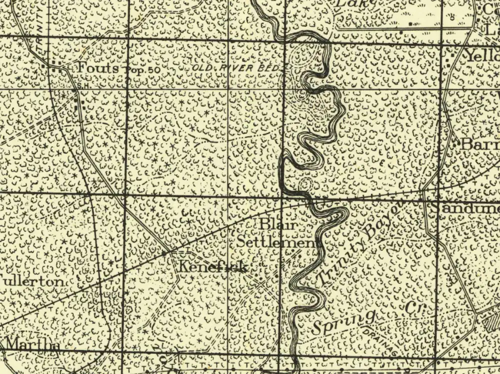
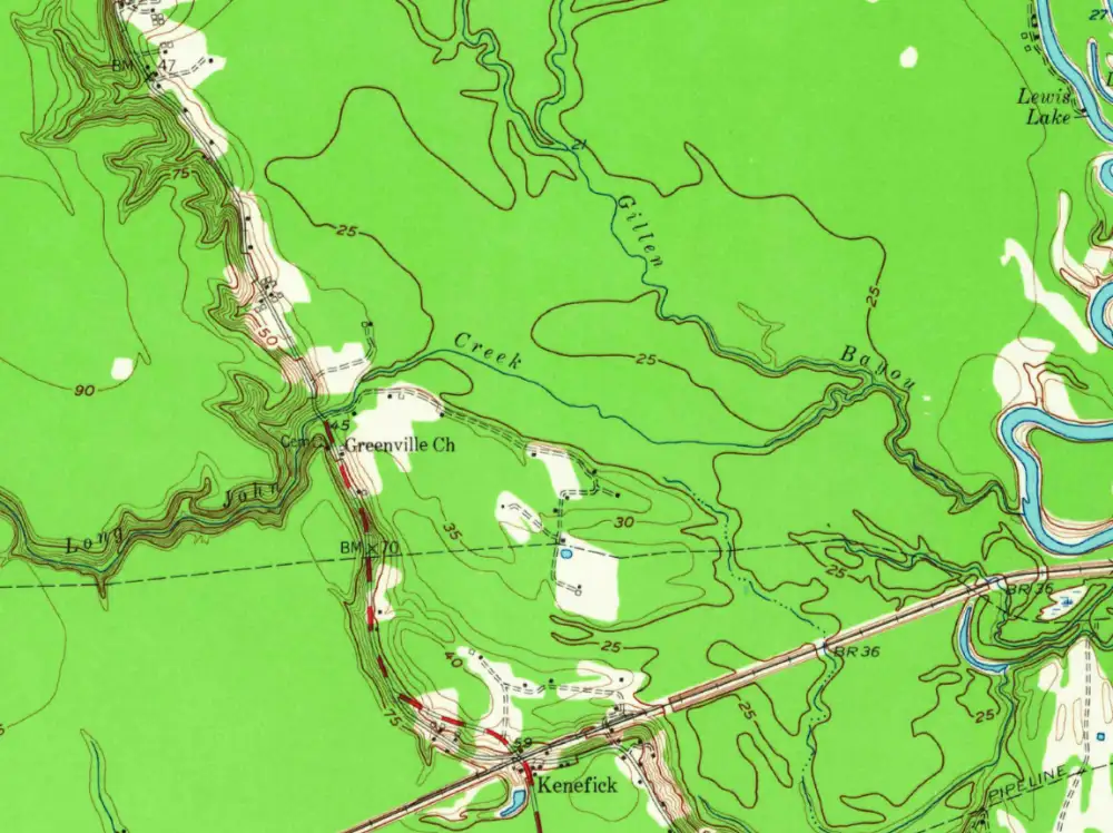
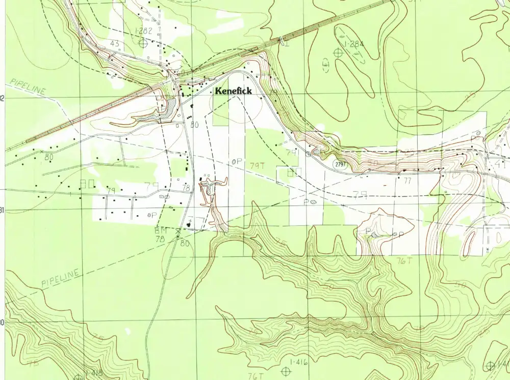
If you have information about the Fouts school, Blair Settlement or Greenville Church, please share your story. Maps courtesy of the U.S. Geological Survey Historical Topographic Map Collection.
Kenefick Stories
Stories and photos shared by Kenefick residents.
Local Legends
These stories are part of local tradition and have not been verified. If you know more, please share a story.
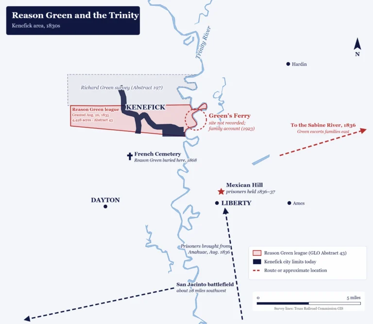
- Green’s Ferry The remains of an old wooden boat in a pond near the Trinity River are said to be from Reason Green’s ferry. Read about Reason Green.
- Bigfoot Liberty County is often listed among the Texas counties with the most reported Bigfoot sightings, many of them in the Trinity River bottoms.
- The black panther Residents have long reported a large black cat in the woods. Texas Parks and Wildlife says no black panthers live in Texas.
Share your Kenefick story
Residents with a website account can share a story or old photos. Each submission is reviewed by the City before it is posted.
Log in to share a story. Stories are submitted from a resident account. Your email address is not shown on the website.
Have a bunch of old photos that need scanning?
Volunteers will be available to scan photos at an upcoming City event, and your originals go home with you. Event dates will be posted on the City Events page.
Sources: Handbook of Texas Online, “Kenefick, TX”; Texas Municipal League city directory; Wikipedia, “Kenefick, Texas”; U.S. Census Bureau. To report a correction, use Ask the City Council.